2011年11月26日土曜日

(旧)武石村:ツツジとうつくしの塔(展示)

(旧)武石村:ツツジとうつくしの塔(展示)
日時:2011年11月24日木曜日 15:52
場所:36.302918,138.251052
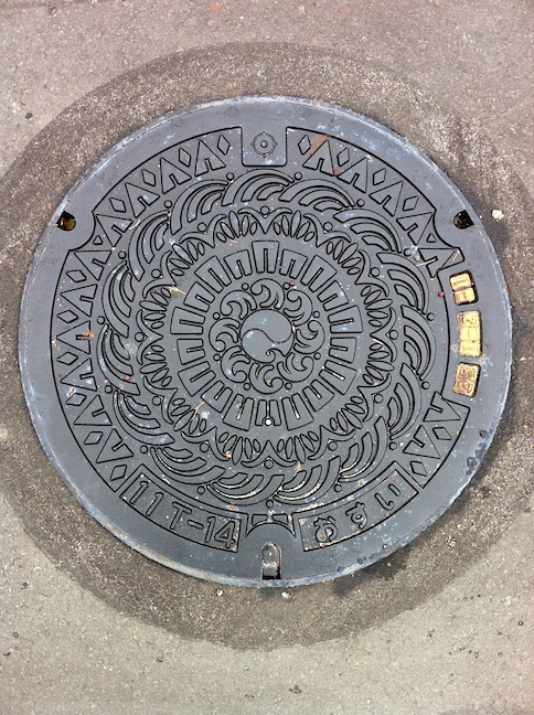
説明:村の花「ツツジ」と美ヶ原高原のシンボル「うつくしの塔」(武石地区クリーンセンターにて撮影)


Previously called Takeshi-mura: Azalea and Utsukushi tower (display)
Date: Thu., Nov. 24th 2011 15:52
Location: 36.302918,138.251052
Remarks: Design of village flower "Azalea" and symbolic monument of Utsukushi-gahara plateau "Utsukushi tower"

小諸市:コモロスミレ、ウメ、浅間山、懐古園の三の門(展示)

小諸市:コモロスミレ、ウメ、浅間山、懐古園の三の門(展示)
日時:2011年11月24日木曜日 14:45
場所:36.329261,138.405135
説明:市の花「コモロスミレ」と市の木「ウメ」、中央に浅間山と懐古園の三の門のデザイン(小諸市浄化管理センターにて撮影)


Komoro: Komoro Violet, Plum flower, Asama mountain and Kaikoen (Display)
Date: Thu., Nov. 24th 2011 14:45
Location: 36.329261,138.405135
Remarks: Design of city flower "Komoro Violet", city tree "Plum Tree", Asama mountain and Kaikoen in the center

御代田町:ヤマユリ、浅間山の稜線(展示)

御代田町:ヤマユリと浅間山の稜線(展示)
日時:2011年11月24日木曜日 14:11
場所:36.301552,138.499789
説明:町の花「ヤマユリ」と浅間の稜線のデザイン(御代田浄化管理センターにて撮影)


Miyota-machi: Gold-banded lily and ridge of Mt. Asama (Display)
Date: Thu., Nov. 24th 2011 14:11
Location: 36.301552,138.499789
Remarks: Design of village flower "Gold-banded lily" and ridge of Mt. Asama

軽井沢町:浅間山と白樺(展示)

軽井沢町:浅間山と白樺(展示)
日時:2011年11月24日木曜日 13:41
場所:36.329371,138.592036
説明:浅間山と白樺のデザイン、道路に敷設されている物とは同じ配色(軽井沢浄化管理センターにて撮影)


Karuizawa-machi: Mt. Asama and white birch (Display)
Date: Thu., Nov. 24th 2011 13:41
Location: 36.329371,138.592036
Remarks: Design of Mt. Asama and white birch, same color scheme with the one on the road

軽井沢町:浅間山と白樺(展示)

軽井沢町:浅間山と白樺(展示)
日時:2011年11月24日木曜日 13:40
場所:36.329371,138.592036
説明:浅間山と白樺のデザイン、道路に敷設されている物とは別の配色(軽井沢浄化管理センターにて撮影)


Karuizawa-machi: Mt. Asama and white birch (Display)
Date: Thu., Nov. 24th 2011 13:40
Location: 36.329371,138.592036
Remarks: Design of Mt. Asama and white birch, different color scheme compared to the one on the road

軽井沢町:浅間山、コブシ、アカハラ

軽井沢町:浅間山、コブシ、アカハラ
日時:2011年11月24日木曜日 13:09
場所:36.313928,138.591015
説明:浅間山、町の木「コブシ」と町の鳥「アカハラ」のデザイン(詳細確認中)


Karuizawa-machi: Mt. Asama, Kobushi magnolia and Brown-headed thrush
Date: Thu., Nov. 24th 2011 13:09
Location: 36.313928,138.591015
Remarks: Design of Mt. Asama, town tree "Kobushi Magnolia" and town bird "Brown-headed thrush"

上田市菅平:ラグビー(展示)

上田市菅平:ラグビー(展示)
日時:2011年11月24日木曜日 10:38
場所:36.51181,138.341539
説明:「ラグビー」のデザイン(菅平浄化センターにて撮影)


Ueda city Sugadaira: Rugby (Display)
Date: Thu., Nov. 24th 2011 10:38
Location: 36.51181,138.341539
Remarks: Design of "Rugby"

(旧)丸子町:シカ親子と鹿教湯温泉

(旧)丸子町:シカ親子と鹿教湯温泉
日時:2011年11月24日木曜日 10:38
場所:36.365665,138.294834
説明:シカの親子が鹿教温泉に浸かるデザイン(シカが温泉を猟師に教えた伝承に因む)


Previously called Maruko-machi: Deer family and Kakeyu hot spring
Date: Thu., Nov. 24th 2011 10:38
Location: 36.365665,138.294834
Remarks: Design of deer family is taking Kakeyu hot spring (based on the folklore which deer taught a hunter nice hot spring at Kakeyu)

(旧)和田村:木曽海道 和田(展示)

(旧)和田村:木曽海道 和田(展示)
日時:2011年11月24日木曜日 9:46
場所:36.289225,138.253466
説明:「木曽海道六十九次 和田」のデザイン(長門水処理センターにて撮影)


Previously called Wada-mura: Kiso Kaido Wada (Display)
Date: Thu., Nov. 24th 2011 9:46
Location: 36.289225,138.253466
Remarks: Design of "Kiso Kaido Rokujyu-kyu tsugi Wada"

(旧)長門町:チョウゲンボウ、カラマツ、ミツバツツジ(展示)

(旧)長門町:チョウゲンボウ、カラマツ、ミツバツツジ(展示)
日時:2011年11月24日木曜日 9:46
場所:36.289225,138.253466
説明:町の鳥「チョウゲンボウ」、町の木「カラマツ」と町の花「ミツバツツジ」のデザイン(長門水処理センターにて撮影)


Previously called Nagato-machi: Kestrel, Larch and Mitsuba azalea (Display)
Date: Thu., Nov. 24th 2011 9:46
Location: 36.289225,138.253466
Remarks: Design of town bird "Kestrel", town tree "Larch" and town flower "Mitsuba Azalea"

2011年11月25日金曜日

浜松市:凧揚げ合戦と海(都市下水、展示)

浜松市:凧揚げ合戦と海(都市下水、展示)
日時:2011年11月22日火曜日 16:32
場所:34.685029,137.731776
説明:「凧揚げ合戦」と「海」のデザイン、都市下水用(中部浄化センターにて撮影)


Hamamatsu City: Kite battle and ocean (municipal sewage、display)
Date: Tue., Nov. 22th 2011 16:32
Location: 34.685029,137.731776
Remarks: Design of "Kite battle" and "Ocean" for municipal sewage

浜松市:遠州灘、ビル、人、川、山(汚水)

浜松市:遠州灘、ビル、人、川、山(汚水)
日時:2011年11月23日水曜日 8:59
場所:34.812156,137.685028
説明:新市章を中心に、外に向かって海岸部(遠州灘)、街(ビル)、人、川(天竜川)、山間部のデザイン


Hamamatsu City: Ensyu shore, buildings, people, rivers and mountains (sewage)
Date: Wed., Nov. 23rd 2011 8:59
Location: 34.812156,137.685028
Remarks: Design of new city emblem in the center and Sea shore (Ensyu), City (buildings), People, Rivers (Tenryu river) and mountains

浜松市:下水道(展示、化粧蓋)

浜松市:下水道(展示、化粧蓋)
日時:2011年11月22日火曜日 16:32
場所:34.685029,137.731776
説明:中央に旧市章のデザインの化粧蓋(中部浄化センターにて撮影)


Hamamatsu City: Sewage (display, decoration cover)
Date: Tue., Nov. 22th 2011 16:32
Location: 34.685029,137.731776
Remarks: Design of old Hamamatsu city emblem in the center

浜松市:下水道(展示、色違い)

浜松市:下水道(展示、色違い)
日時:2011年11月22日火曜日 16:32
場所:34.685029,137.731776
説明:中央に旧市章のデザイン(中部浄化センターにて撮影)


Hamamatsu City: Sewage (display, color variation)
Date: Tue., Nov. 22th 2011 16:32
Location: 34.685029,137.731776
Remarks: Design of old Hamamatsu city emblem in the center

浜松市:下水道(展示、色違い)

浜松市:下水道(展示、色違い)
日時:2011年11月22日火曜日 16:31
場所:34.685029,137.731776
説明:中央に旧市章のデザイン(中部浄化センターにて撮影)


Hamamatsu City: Sewage (display, color variation)
Date: Tue., Nov. 22th 2011 16:31
Location: 34.685029,137.731776
Remarks: Design of old Hamamatsu city emblem in the center

浜松市:下水道(展示)

浜松市:下水道(展示)
日時:2011年11月22日火曜日 16:31
場所:34.685029,137.731776
説明:中央に旧市章のデザイン(中部浄化センターにて撮影)


Hamamatsu City: Sewage (display)
Date: Tue., Nov. 22th 2011 16:31
Location: 34.685029,137.731776
Remarks: Design of old Hamamatsu city emblem in the center

浜松市:都田テクノポリス(展示)

浜松市:都田テクノポリス(展示)
日時:2011年11月22日火曜日 16:30
場所:34.685029,137.731776
説明:新都田地区のシンボル「都田テクノポリス」のデザイン(中部浄化センターにて撮影)


Hamamatsu City: Miyakoda Technopolis (display)
Date: Tue., Nov. 22th 2011 16:30
Location: 34.685029,137.731776
Remarks: Design of the symbol of Shin Miyakoda district "Miyakoda Technopolis"

浜松市:下水道(雨水)

浜松市:下水道(雨水)
日時:2011年11月22日火曜日 8:13
場所:34.706618,137.736298
説明:中央に旧市章と外周に「Hamamatsu」の文字のデザイン


Hamamatsu City: Sewer (rain water)
Date: Tue., Nov. 22nd 2011 8:13
Location: 34.706618,137.736298
Remarks: Design of old Hamamatsu city emblem in the center and the letters of Hamamatsu in the periphery

浜松市:遠州灘、ビル、人、川、山(合流)

浜松市:遠州灘、ビル、人、川、山(合流)
日時:2011年11月22日火曜日 8:03
場所:34.703818,137.733815
説明:新市章を中心に、外に向かって海岸部(遠州灘)、街(ビル)、人、川(天竜川)、山間部のデザイン


Hamamatsu City: Ensyu shore, buildings, people, rivers and mountains (mixed)
Date: Tue., Nov. 22nd 2011 8:03
Location: 34.703818,137.733815
Remarks: Design of new city emblem in the center and Sea shore (Ensyu), City (buildings), People, Rivers (Tenryu river) and mountains

浜松市:下水道(汚水)

浜松市:下水道(汚水)
日時:2011年11月22日火曜日 7:57
場所:34.705679,137.733117
説明:中央に旧市章のデザイン


Hamamatsu City: Sewer (sewage)
Date: Tue., Nov. 22nd 2011 7:57
Location: 34.705679,137.733117
Remarks: Design of old Hamamatsu city emblem in the center

浜松市:下水道

浜松市:下水道
日時:2011年11月22日火曜日 7:56
場所:34.705974,137.733434
説明:中央に旧市章のデザイン


Hamamatsu City: Sewage
Date: Tue., Nov. 22nd 2011 7:56
Location: 34.705974,137.733434
Remarks: Design of old Hamamatsu city emblem in the center

浜松市:下水道(ダイヤブロック)

浜松市:下水道(ダイヤブロック)
日時:2011年11月22日火曜日 7:56
場所:34.705961,137.733627
説明:旧市章を中央にダイヤブロックパターンのデザイン


Hamamatsu City: Sewage (Diamond block pattern)
Date: Tue., Nov. 22nd 2011 7:56
Location: 34.705961,137.733627
Remarks: Design of old Hamamatsu city emblem in the center with diamond block pattern

浜松市:遠州灘、ビル、人、川、山(雨水)

浜松市:遠州灘、ビル、人、川、山(雨水)
日時:2011年11月22日火曜日 7:54
場所:34.706439,137.733943
説明:新市章を中心に、外に向かって海岸部(遠州灘)、街(ビル)、人、川(天竜川)、山間部のデザイン


Hamamatsu City: Ensyu shore, buildings, people, rivers and mountains (rain water)
Date: Tue., Nov. 22nd 2011 7:54
Location: 34.706439,137.733943
Remarks: Design of new city emblem in the center and Sea shore (Ensyu), City (buildings), People, Rivers (Tenryu river) and mountains

2011年11月14日月曜日

丹波山村:コマドリ、ブナ、イワツツジ

丹波山村:コマドリ、ブナ、イワツツジ
日時:2011年11月13日日曜日 15:35
場所:35.793050,138.914900
説明:村の鳥「コマドリ」、村の木「ブナ」、村の花「イワツツジ」のデザイン


Tanbayama-mura: Robin, beech and Vaccinium praestans
Date: Sun., Nov. 13th 2011 15:35
Location: 35.793050,138.914900
Remarks: Design of village bird "Robin", village tree "Beech" and village flower "Vaccinium praestans"

小菅村:ヤマメとミツバツツジ

小菅村:ヤマメとミツバツツジ
日時:2011年11月13日日曜日 15:07
場所:35.746548,138.958662
説明:初めて人工ふ化が成功した「ヤマメ」と村の花「ミツバツツジ」のデザイン


Kosuge-mura: Trout and Mitsuba azalea
Date: Sun., Nov. 13th 2011 15:07
Location: 35.746548,138.958662
Remarks: Design of "Trout" which is Japanese first successful artificial incubation and village flower "Mitsuba azalea"

都留市:ウメ

都留市:ウメ
日時:2011年11月13日日曜日 13:59
場所:35.575309,138.928516
説明:市の花「ウメ」のデザイン


Tsuru: Plum
Date: Sun., Nov. 13th 2011 13:59
Location: 35.575309,138.928516
Remarks: Design of city flower "Plum"

西桂町:スイセンとシジュウカラ

西桂町:スイセンとシジュウカラ
日時:2011年11月13日日曜日 13:14
場所:35.521997,138.849332
説明:町の花「スイセン」と町の鳥「シジュウカラ」のデザイン


Nishikatsura-cyo: Daffodil and Japanese Tit
Date: Sun., Nov. 13th 2011 13:14
Location: 35.521997,138.849332
Remarks: Design of town flower "Daffodil" and town bird "Japanese Tit"

富士河口湖町:河口湖、河口湖大橋、富士山、ラベンダー、ツキミソウ

富士河口湖町:河口湖、河口湖大橋、富士山、ラベンダー、ツキミソウ
日時:2011年11月13日日曜日 12:13
場所:35.524957,138.763324
説明:「河口湖」、「河口湖大橋」、「富士山」、「ラベンダー」と町の花「ツキミソウ」のデザイン


Fujikawaguchiko-machi: Lake Kawaguchi, Kawaguchi great bridge, Mt. Fuji, lavender and evening primrose
Date: Sun., Nov. 13th 2011 12:13
Location: 35.524957,138.763324
Remarks: Design of Lake Kawaguchi, Kawaguchi great bridge, Mr. Fuji, Lavender and Evening Primrose

(旧)足和田村:ヤマユリとキジ

(旧)足和田村:ヤマユリとキジ
日時:2011年11月13日日曜日 11:48
場所:35.511068,138.719245
説明:村の花「ヤマユリ」と村の鳥「キジ」のデザイン


Previously called Ashiwada-mura: Gold-banded lily and pheasant
Date: Sun., Nov. 13th 2011 11:48
Location: 35.511068,138.719245
Remarks: Design of village flower "Gold-banded lily" and village bird "Pheasant"

富士河口湖町:クニマスと富士山

富士河口湖町:クニマスと富士山
日時:2011年11月13日日曜日 11:42
場所:35.509754,138.716769
説明:クニマスと富士山のデザイン


Fujikawaguchiko-machi: Kunimasu and Mt. Fuji
Date: Sun., Nov. 13th 2011 11:42
Location: 35.509754,138.716769
Remarks: Design of Kunimasu and Mr. Fuji

(旧)加悦町:町の風景、加悦大橋、鬼

(旧)加悦町:町の風景、加悦大橋、鬼
日時:2011年11月13日日曜日 11:09
場所:35.504677,138.73411
説明:大江山連峰からの町の風景、加悦大橋、酒呑童子伝説にちなみ鬼のデザイン(道の駅かつやまにて撮影)


Previously called Kaya-cyo: Town scenery, Kaya great bridge and demon
Date: Sun., Nov. 13th 2011 11:09
Location: 35.504677,138.73411
Remarks: Design of town scenery from Ooeyama, Kaya great bridge and demon from Syudouji Folklore

(旧)勝山村:リスとフジザクラ

(旧)勝山村:リスとフジザクラ
日時:2011年11月13日日曜日 11:08
場所:35.504813,138.734171
説明:村の動物「リス」と村の木「フジザクラ」の花のデザイン


Previously called Katsuyama-mura: Squirrel and mamezakura
Date: Sun., Nov. 13th 2011 11:08
Location: 35.504813,138.734171
Remarks: Design of village animal "Squirrel" and flowers of village tree "Mamezakura"

いわき市:汚水

いわき市:汚水
日時:2011年11月13日日曜日 10:41
場所:35.481516,138.70644
説明:中央に市章のデザイン(鳴沢村役場にて撮影)


Iwaki: Sewage
Date: Sun., Nov. 13th 2011 10:41
Location: 35.481516,138.70644
Remarks: Design of city emblem in the center

(旧)河口湖町:ツキミソウ

(旧)河口湖町:ツキミソウ
日時:2011年11月13日日曜日 9:58
場所:35.496006,138.755546
説明:町の花「ツキミソウ」のデザイン(富士河口湖町編入後のマンホール)


Previously called Kawaguchiko-machi: Evening primrose
Date: Sun., Nov. 13th 2011 9:58
Location: 35.496006,138.755546
Remarks: Design of town flower "Evening Primrose" (Fujikawaguchiko-machi version)

(旧)河口湖町:ツキミソウ

(旧)河口湖町:ツキミソウ
日時:2011年11月13日日曜日 9:52
場所:35.497548,138.754921
説明:町の花「ツキミソウ」のデザイン


Previously called Kawaguchiko-machi: Evening primrose
Date: Sun., Nov. 13th 2011 9:52
Location: 35.497548,138.754921
Remarks: Design of town flower "Evening Primrose"

富士吉田市:富士山、フジザクラ、シラカバ、アカゲラ

富士吉田市:富士山、フジザクラ、シラカバ、アカゲラ
日時:2011年11月13日日曜日 9:13
場所:35.483436,138.798072
説明:富士山、市の花「フジザクラ」、市の木「シラカバ」と市の鳥「アカゲラ」のデザイン


Fujiyoshida: Mt. Fuji, mamezakura, white birch, great spotted woodpecker
Date: Sun., Nov. 13th 2011 9:13
Location: 35.483436,138.798072
Remarks: Design of Mt. Fuji, city flower "Mamezakura", city tree "White Birch" and city bird "great spotted woodpecker"

富士吉田市:富士山、フジザクラ、アカゲラ

富士吉田市:富士山、フジザクラ、アカゲラ
日時:2011年11月13日日曜日 8:27
場所:35.483584,138.805894
説明:富士山、市の花「フジザクラ」、市の鳥「アカゲラ」のデザイン


Fujiyoshida: Mt. Fuji, mamezakura, great spotted woodpecker
Date: Sun., Nov. 13th 2011 8:27
Location: 35.483584,138.805894
Remarks: Design of Mt. Fuji, city flower "Mamezakura" and city bird "great spotted woodpecker"

忍野村:忍野八海と富士山(カラー)

忍野村:忍野八海と富士山(カラー)
日時:2011年11月13日日曜日 8:08
場所:35.460377,138.847618
説明:忍野八海の風景と富士山のデザイン(忍野村役場横の小道にて撮影)


Oshino-mura: Oshino Hakkai and Mt. Fuji (color)
Date: Sun., Nov. 13th 2011 8:08
Location: 35.460377,138.847618
Remarks: Design of scenery of Oshino Hakkai and Mt. Fuji

山中湖村:富士山とハクチョウ

山中湖村:富士山とハクチョウ
日時:2011年11月13日日曜日 7:50
場所:35.423321,138.849673
説明:富士山と村の鳥「ハクチョウ」のデザイン


Yamanakako-mura: Mt. Fuji and swans
Date: Sun., Nov. 13th 2011 7:50
Location: 35.423321,138.849673
Remarks: Design of Mt. Fuji and village bird "Swan"

2011年11月6日日曜日

小布施町:浪図(展示)

小布施町:浪図(展示)
日時:2011年11月5日土曜日 16:43
場所:36.697544,138.311943
説明:葛飾北斎の「怒濤」図(男浪)がデザイン(小布施町役場にて撮影)


Obuse-machi: Waves (display)
Date: Sat., Nov. 5th 2011 16:43
Location: 36.697544,138.311943
Remarks: Design of Hokusai's "Doto" (Onami) (taken at Obuse Town Hall)

2011年11月3日木曜日

(旧)安曇村:カッパ、上高地、梓川と河童橋(カラー)

(旧)安曇村:カッパ、上高地、梓川と河童橋(カラー)
日時:2011年11月3日木曜日 10:52
場所:36.183083,137.784959
説明:上高地、梓川、河童橋を眺めるカッパのデザイン(旧安曇村役場にて撮影)


Previously called Azumi-mura: Kappa, Kami-kochi, Azusa river and Kappa bridge (color)
Date: Thu., Nov. 3rd 2011 10:52
Location: 36.183083,137.784959
Remarks: Design of Kappa (folklore creature) looks at Kami-kochi, Azusa river and Kappa bridge